Top 10 Unforgettable Sights on Iceland’s Ring Road
- Ring Road of Iceland
- 17 Sep 2024

What is the Ring Road of Iceland
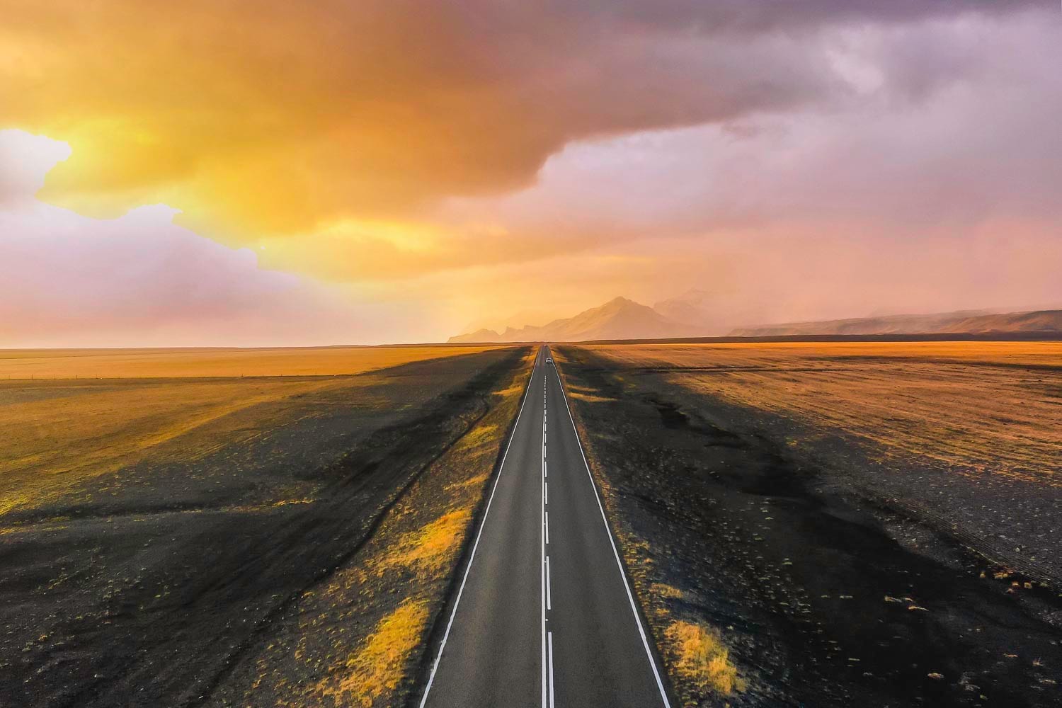
The Ring Road of Iceland, also known as Route 1 (Þjóðvegur 1 in Icelandic), is the main highway that circles the entire country.
Spanning approximately 1,332 kilometers (828 miles), it connects most of Iceland’s inhabited areas and offers access to many of the country’s most famous natural attractions.
Many who travel the Ring Road often say that it is not just a route to attractions but an attraction in itself, offering endless sights and stunning scenery.
After much consideration, I’ve compiled a list of the top 10 attractions you must visit along the Ring Road. They are relatively easy to reach, not much driving off the Ring Road, and they are all so unique and beautiful. Now, let’s begin by exploring these must-see sites along Iceland’s longest highway.
Top 10 Must-Sees Along Iceland’s Ring Road
Coming up with a list of just 10 attractions is challenging due to the sheer number of sights along the Ring Road. To provide the best options, I chose a diverse range of attractions that represent Iceland as the ‘Land of Fire and Ice.’ Along your journey, you will encounter waterfalls, volcanic craters, glaciers, canyons, geothermal hot springs, beaches, ice caves, art installations, and more.
Skogafoss Waterfall in South Iceland
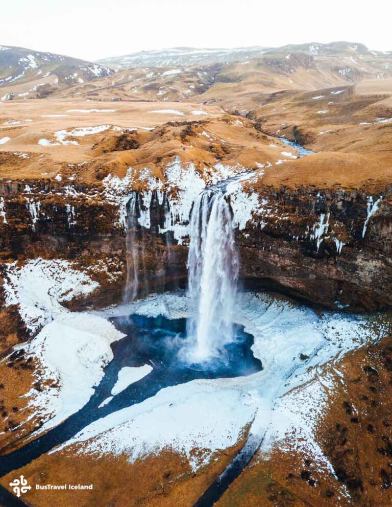
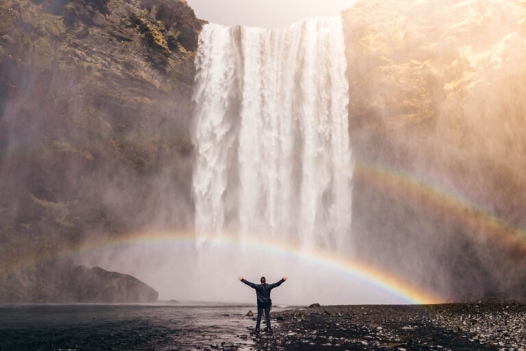
About 155 km (96.3 miles) away from Reykjavik, the capital city of Iceland, Skógafoss waterfall reveals itself as you pass the colossal mountain near the road. The sight is absolutely stunning from afar, with the downstream forming a serene lake beneath the mountain cliff, reflecting Skógafoss’ majestic vision in tranquil contrast.
At 60 meters high and 25 meters wide, Skógafoss is one of Iceland’s largest and most iconic waterfalls. The powerful cascade creates a constant mist that often produces beautiful rainbows on sunny days, adding to the magical atmosphere. You can climb the staircase alongside the waterfall to reach the top, offering breathtaking views of the surrounding landscape and the Skógar river.

The area around Skógafoss is rich in legend and folklore, a crucial part of Icelandic culture.. According to local tales, a treasure chest is hidden behind the waterfall, placed there by the first Viking settler in the region. The waterfall’s sheer force and the lush greenery around it make it a favorite spot for photographers and nature enthusiasts.
As one of the main highlight attractions in day tours to South Iceland, Skogafoss provides a lot of fun for you to experience the splash and the mist, to see the rainbows and the landscapes, and to listen to the folklores and legends told by the knowledge guides, especially when you are on a small-group South Iceland tour.

The source of Skógafoss is the Eyjafjallajökull volcano glacier, which also feeds another famous nearby waterfall, Seljalandsfoss. This waterfall is renowned for the unique experience of being able to walk behind it.
Reynisfjara Black Sand Beach On the South Coast
One of Iceland’s famous natural wonders is Reynisfjara black sand beach. Here, you will find towering basalt columns forming a high wall, and a humongous cave beneath a mountain with a ceiling so smooth and hexagonal that it resembles something from outer space. Offshore, a group of colossal sea stacks stands timelessly, enduring the giant waves that crash against them. The highlight of Reynisfjara is the black sand beach itself, extending endlessly with the stark contrast of white waves crashing onto pitch-black sands.
But please be aware that there are often sneaker waves on the beach. Do listen to your tour guide’s instructions when you are on a South Shore day tour, or watch out for the warning board and lights if you are traveling on your own.

From Reynisfjara, if the weather allows, you will be able to see Dyrhólaey Arch, a rock formation protruding into the ocean with a hole through it, and Arnardrangur, or Eagle Rock, a giant cliff standing alone on the beach.
These features of Reynisfjara create a dramatic panorama, showcasing Iceland’s immense geological power.
Not far from Reynisfjara, you will find Vík í Mýrdal, a picturesque sea-front fishing town located at the southernmost point of the island. It offers a beautiful blend of culture and nature, making it a popular starting point for a variety of activities.
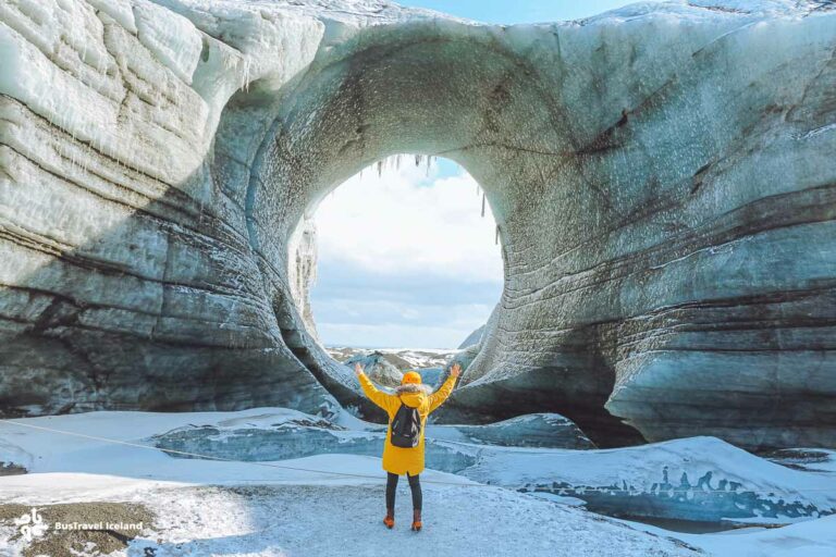
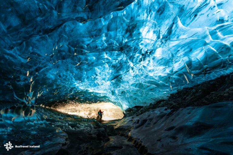
You can explore the Katla ice cave, accessible year-round, go horseback riding on the black sand beach, enjoy a paragliding adventure, take a zipline tour, and much more. Many people opt for a combo tour, combining sightseeing in South Iceland with activities from Vík, creating a wonderful day on Iceland’s south shore.

Jokulsarlon Glacier Lagoon and Fellsfjara the Diamond Beach in Southeast Iceland
A must-visit in Iceland, Jökulsárlón Glacier Lagoon is located right off the Ring Road in the Southeast region. Fed by meltwater from the immense Breiðamerkurjökull outlet glacier, part of the mighty Vatnajökull glacier, Jökulsárlón began to emerge in the 1970s as global warming became more visible. As glaciers started to retreat faster, the resulting meltwater formed this stunning lagoon.
Now, Jokulsarlon is the deepest lake in Iceland, with depths reaching around 248 meters (814 feet).
Why is Jökulsárlón so special? The reason lies in the unique formation of the lagoon. As glacial ice breaks free from the glacier tongue, it drifts across the vast surface of Jökulsárlón, changing shapes and colors as it moves until the waves of the North Atlantic Ocean carry it out to sea.
This is why the icebergs, big or small, float on Jökulsárlón. Some are shades of blue, some have grayish or brownish stripes from layers of volcanic ash deposited during ancient eruptions, and others are crystal clear. That is why Jökulsárlón is such an enchanting place to witness.

Fellsfjara, commonly known as Diamond Beach, is located next to Jökulsárlón. It features an extensive stretch of fine black sand formed from volcanic rocks over time. Similar to Reynisfjara, Fellsfjara’s black sand beach is renowned for the diamond-like glacier ice chunks stranded on the shore. Under sunlight, the glacier ice glitters like diamonds, accompanied by the endless crashing sounds of the waves that wash over you. Diamond Beach offers an experience of ultimate Icelandic charm.Jokulsarlon, the Diamond Beach, and its surrounding area, all belong to the vast Vatnajokull National Park. In winter, the area turns into a snowy wonderland with a range of adventures to be explored. The most popular ones being ice caving, and glacier hiking.

Djúpivogur in East Iceland
After exploring the entire south shore of Iceland, it’s time to experience some enjoyable and even quirky Icelandic culture. One thing you’ll notice instantly is that Icelanders have a fondness for art installations. The installations in Djúpivogur, East Iceland, are particularly memorable. One of the most amusingly named installations is ‘Eggin í Gleðivík,’ which translates to ‘The Eggs at Merry Bay’ in English.
The Eggs at Merry Bay in Djúpivogur, are a unique outdoor art installation by artist Sigurður Guðmundsson. Situated along the scenic harbor, the display features 34 large granite eggs, each representing a different bird species native to the area.

The meticulously crafted eggs vary in size and detail, reflecting the diversity of local birdlife. This captivating attraction blends art with nature, offering a delightful and thought-provoking experience for you. The eggs not only highlight the region’s rich avian biodiversity but also provide a striking visual landmark against the stunning backdrop of Djúpivogur’s coastal landscape.
Djupivogur itself is a picturesque fishing village with colorful houses up and down the hilly area. Inside one of the beautiful houses, lies the Auðunn’s Stone & Mineral collection. Auðunn’s stone collection features unique East Iceland rocks and minerals. Bones Stick & Stones 2 showcases minerals, zeolites, sculptures, and handmade souvenirs. JFS Arts Workshop displays a beautiful stone garden. Don’t miss Langabúð museums for local heritage and Ríkarður Jónsson’s works.

It’s also good to know that Borgarfjörður Eystri is a two-hour drive from Djúpivogur and offers a spectacular spot to see Atlantic puffins up close. If you travel there in summer, be sure to stop by and see these adorable seabirds.
Stuðlagil glacial canyon in East Iceland
Stuðlagil Glacial Canyon, located in the Jökuldalur Valley in East Iceland, is a breathtaking sight renowned for its dramatic basalt column formations and the vibrant blue-green glacial river that flows through it.
The canyon was formed through a combination of volcanic and glacial activity. The striking basalt columns lining the canyon walls were created by slow-cooling basaltic lava, which contracted and cracked into hexagonal patterns.

Over thousands of years, the Jökla River, fed by meltwater from the Vatnajökull glacier, carved out the canyon. For much of this time, the river was choked with glacial sediment, keeping the canyon hidden. The Kárahnjúkar Hydroelectric Project, completed in 2007, diverted a significant portion of the Jökla River, lowering water levels and revealing the stunning basalt columns and deep canyon previously submerged.
Today, Stuðlagil is accessible via hiking trails, offering you breathtaking views and a unique glimpse into Iceland’s dynamic geological history.

There are two ways to access Stuðlagil Canyon. The first involves an extensive hike of about 5 km (3 miles) one-way on uneven, hilly, and stony terrain, leading to the photogenic and iconic spot of the canyon. The second, easier option is to walk down a staircase to a lower viewing deck for an up-close look at the canyon. This side features a large parking lot, a paid restroom, and a campground.
If you are planning to visit the canyon but don’t want to spend too much time exploring it on your Ring Road trip, then I recommend signing up for the 6-day Ring Road tour that takes you on day 4.
Dettifoss and Godafoss waterfalls in North Iceland
Dettifoss and Goðafoss are two of North Iceland’s most stunning and renowned waterfalls, each offering unique and captivating experiences.
Dettifoss, located in Vatnajökull National Park, is Europe’s most powerful waterfall, with an awe-inspiring width of 100 meters and a drop of 44 meters. The sheer force and volume of water crashing down the rugged canyon create a dramatic and thunderous spectacle.

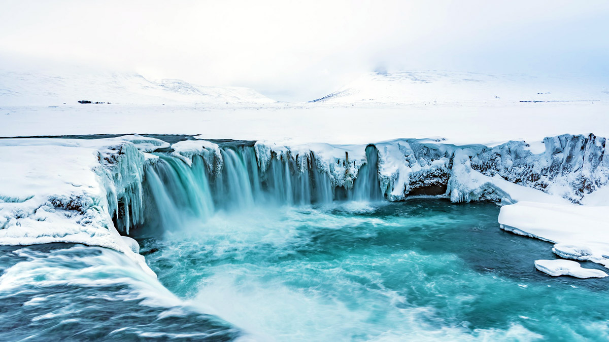
In contrast, Goðafoss, known as the “Waterfall of the Gods,” boasts a serene beauty with its semicircular shape and cascading water that falls from a height of 12 meters over a width of 30 meters. Steeped in history, Goðafoss is famously associated with Iceland’s conversion to Christianity in the year 1000, when pagan idols were thrown into the falls.

Together, these waterfalls highlight the diverse and magnificent natural beauty of North Iceland, drawing you from around the world to marvel at their splendor.
The distance between Dettifoss and Goðafoss waterfalls in North Iceland is approximately 150 kilometers (93 miles). This journey typically takes around 2 to 2.5 hours by car, depending on the route and road conditions.
As the highlights of Iceland’s northern region, Dettifoss and Gullfoss waterfalls are visited by most tours, both day tours departing from Akureyri, and multi-day tours traveling around Iceland.They are usually scheduled to be visited on the same day, with a stay in Akureyri for the night – previous or same day’s evening.
North Iceland’s Lake Myvatn and Its surrounding area
Lake Mývatn, located in North Iceland, is a captivating natural lake renowned for its unique geological formations, diverse birdlife, and vibrant geothermal activity. Formed by a basaltic lava eruption around 2,300 years ago, the Myvatn lake spans about 37 square kilometers and is surrounded by a variety of intriguing landscapes.
“With extra time to explore, why not treat yourself to a refreshing dip in the Myvatn Nature Bath? It’s an unforgettable experience!
It is also a haven for bird watchers, particularly during the summer months when the area becomes a nesting ground for a wide range of bird species. The rich wetlands around the lake attract species such as the harlequin duck, Barrow’s goldeneye, and the great northern diver, making it one of Europe’s premier bird-watching locations.

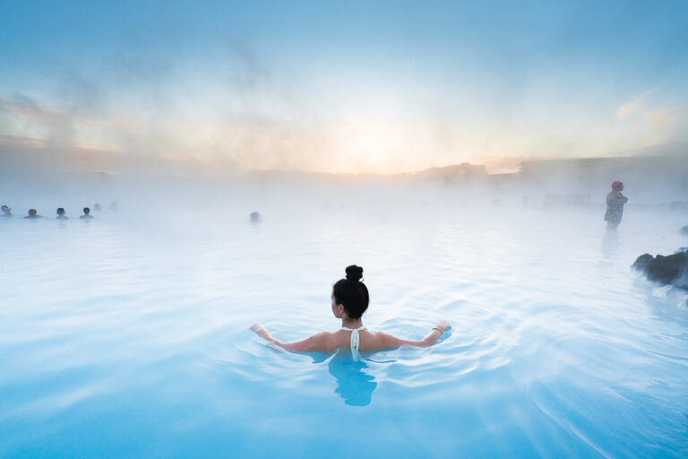
By its vicinity, you will find the largest and most striking-looking lava formations at Dimmuborgir, a labyrinth of bizarre lava formations and caves, creating an almost otherworldly scenery. Nearby, the pseudocraters at Skútustaðir, formed by steam explosions when lava flowed over wetlands, offer another unique geological sight. The geothermal area of Hverir, also known as Námaskarð, located at the base of Námafjall Mountain, is characterized by its steaming fumaroles and bubbling mud pots, painting a surreal and colorful landscape. Not far from Hverir, the Mývatn Nature Baths provide a more tranquil and less crowded alternative to the Blue Lagoon, where you can soak in the mineral-rich, milky blue waters while enjoying panoramic views of the surrounding nature.

The region is steeped in volcanic activity. The nearby Krafla volcano, one of Iceland’s most active volcanic areas, has a history of eruptions, the most recent series occurring between 1975 and 1984. You can explore the Leirhnjúkur lava fields, walk among steaming vents, and witness the vivid colors and stark contrasts of newly formed lava landscapes in North Iceland.
The area also offers numerous hiking trails, providing opportunities to explore the diverse terrain, from lush wetlands to stark volcanic craters. The serene Höfði peninsula offers trails with stunning views over the lake, and the nearby Grjótagjá cave, with its hot spring, adds to the region’s geothermal charm.

Together, Lake Mývatn and its surroundings present a wide range of natural and geological adventures, offering you a diverse and captivating experience that highlights the dramatic and dynamic landscape of North Iceland.
These major attractions around Lake Mývatn are popular stops for day trips from Akureyri and multi-day tours around Iceland. Your guide will share fascinating facts and insights while providing an expert’s perspective on the area.
Hvítserkur sea stack in Northwest Iceland
You might have already seen a photograph of this place even before you visited Iceland! Hvítserkur is a fascinating sea stack located on the eastern shore of the Vatnsnes Peninsula in Northwest Iceland.
Standing at 15 meters (about 49 feet) tall, Hvítserkur is known for its unique, dinosaur-like shape, which has made it one of the most photographed natural formations in Iceland. The sea stack is made of basalt rock, and over time, the relentless waves of the North Atlantic have eroded the base, creating the distinct arch-like appearance.

The name “Hvítserkur” means “white shirt” in Icelandic, and it is believed to come from the white color of the sea stack’s surface, caused by the guano of the numerous seabirds, including fulmars and gulls, that nest there.
Locally, Hvítserkur is sometimes referred to as “the Troll of Northwest Iceland” due to a popular legend. According to Icelandic folklore, Hvítserkur was once a troll who was caught by the sunlight while trying to destroy the nearby Christian monastery at Þingeyrar. As the sun rose, the troll turned to stone, which is why it remains in the shape it is today.

Hvítserkur is located slightly off the Ring Road by a 26-km drive. You can then access it via a short walk from the nearby parking area, and the site offers excellent opportunities for photography, especially at sunrise or sunset when the light casts dramatic shadows. Hvítserkur is typically included in a Ring Road tour itinerary, provided that road and weather conditions allow.
The surrounding area, including the Vatnsnes Peninsula, is also known for its rich wildlife, particularly seals, which can often be seen lounging on the nearby beaches.
Grábrók volcanic crater in Northwest Iceland
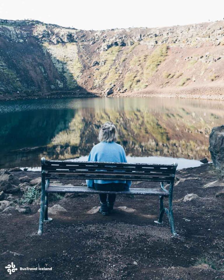
Volcanic craters of all types and shapes are commonly found in the vast wilderness of Iceland, but Grábrók volcanic crater stands out for many reasons. Located in West Iceland, right off the Ring Road, Grábrók’s presence is visible from a distance, making it a distinctive landmark in the region.A captivating geological feature formed approximately 3,000 years ago, Grábrók volcanic crater is located near the town of Bifröst, As the largest of three craters in the area, Grábrók rises 170 meters (560 feet) above the expansive Grábrókarhraun lava field.

Easily accessible from Route 1, you can ascend a well-maintained wooden staircase to reach the crater’s summit, where they are rewarded with panoramic views of the rugged lava field, the serene Lake Hreðavatn, and the surrounding mountainous landscape.
The area boasts diverse plant life, with mosses, lichens, and hardy shrubs thriving in the volcanic soil, adding a touch of greenery to the otherwise stark terrain. It’s especially beautiful in winter when snow blankets the landscape, creating a stark contrast between the endless white expanse and the black lava patterns.

Informational signs along the trail provide insights into the region’s volcanic history, making Grábrók not only a visually stunning destination but also an educational one.
This popular stop along the Ring Road offers a unique glimpse into Iceland’s dynamic geological past and presents an easy yet rewarding hike for travelers.
Grábrók is a highlight stop,typically, on a Ring Road tour of Iceland. You’ll have ample time to hike up and down the crater rim, appreciating the panoramic views, taking pictures, and enjoying the expansive horizon before you.
Hraunfossar waterfalls and Barnafoss waterfall in West Iceland
Hraunfossar and Barnafoss are two captivating waterfalls located close by in West Iceland, near the Hvítá River.
Hraunfossar, meaning “Lava Falls,” is a series of stunning waterfalls formed by rivulets streaming out of the Hallmundarhraun lava field. The lava field originated from an eruption of one of the volcanoes lying beneath the Langjökull glacier. The water, which is remarkably clear and turquoise, flows from beneath the lava for about 900 meters, cascading into the Hvítá River. This creates a unique and beautiful scene as countless small streams emerge from the rugged, moss-covered lava formations, creating a wide and gentle cascade that spreads across the landscape.

Just a short walk upstream from Hraunfossar lies Barnafoss, meaning “Children’s Falls.” Barnafoss is a powerful and tumultuous waterfall with a tragic folklore tale attached to it. According to legend, two children from a nearby farm fell into the waterfall and drowned while attempting to cross a natural stone bridge that once spanned the river. Grief-stricken, their mother destroyed the bridge to prevent future tragedies. Today, Barnafoss is known for its striking, churning waters that rush through a narrow, rocky gorge. The intense flow and the unusual rock formations carved by the water over millennia create a dramatic and mesmerizing sight.

The contrast between Hraunfossar and Barnafoss is striking. Hraunfossar’s gentle, serene beauty is complemented by the raw, untamed power of Barnafoss. Both waterfalls are accessible via well-maintained walking paths and offer various viewing platforms for you to take in their beauty. The surrounding area, with its lush greenery and unique geological formations, adds to the unique charm, making this region a must-visit when you travel along the Ring Road to Iceland’s Western Region.
Hraunfossar and Barnafoss best highlight West Iceland’s diverse nature, revealing the island’s volcanic and glacial history.

If you travel the Ring Road counterclockwise, as most multi-day tours do, West Iceland is usually the last region you explore before reaching Reykjavik. This leg of the journey is typically slow-paced, allowing you to relax and take in the sights. The area around Hraunfossar and Barnafoss waterfalls is perfect for a leisurely walk, offering the opportunity to explore two distinct natural attractions in one go.
The Best Way to Travel Iceland’s Ring Road
The best way to travel along the Ring Road, Iceland’s iconic Route 1, is by taking a guided tour or self-driving.
For those who prefer a more structured experience, guided tours are an excellent option. They provide expert knowledge, eliminate the need for navigation, and often include stops at hidden gems and popular attractions alike. Tours can range from comprehensive multi-day packages to shorter excursions focusing on specific regions.
To travel around Iceland takes at least 6 days, but if you have limited time, these tours are the best options: spending 2 days in Golden Circle & South Iceland with Secret Lagoon and ice caving, or simply having a 2-day Golden Circle & South Iceland sightseeing tour. You will see multiple waterfalls, geysers, glaciers, Thingvellir National Park, and Reynisfjara black sand beach.
Going further south along Route 1, you can also choose to spend 3 days exploring the South Shore of Iceland that has glaciers, black sand beaches, waterfalls, glacier lagoons, and venturing into an ice cave in winter.
Continuing south along Route 1, consider spending 3 days exploring Iceland’s South Shore. This region offers glaciers, black sand beaches, waterfalls, glacier lagoons, and, in winter, the opportunity to venture into an ice cave.
For those interested in exploring North Iceland, you can spend a day visiting Lake Myvatn and its surroundings or the popular Diamond Circle Route. There are also off-the-beaten-path options, such as visiting the unique sights of Laufás Turf House or Ásbyrgi Canyon.
It’s worth noting that the basic Ring Road tour often misses out on the Snæfellsnes Peninsula and Iceland’s Highlands, both of which offer spectacular sights and landscapes. If you want to explore Iceland to the fullest, don’t miss these multi-day tours: a 7-day Ring Road and Snaefellsnes Peninsula tour, or an 8-day Ring Road, Snaefellsnes, and Iceland Highlands tour.
Driving in Iceland on a rental car or a campervan offers the ultimate flexibility to explore at your own pace, allowing you to stop at various attractions, enjoy scenic detours, and linger in your favorite spots. Alternatively, you can book a self-drive tour with a set itinerary, or rent a car and explore at your own pace. The Ring Road is well-maintained and navigable year-round, though summer months (June to August) provide the best driving conditions with extended daylight hours and mild weather. Planning a trip of at least 7 to 10 days is advisable to fully appreciate the diverse landscapes and numerous sites, from waterfalls and glaciers to volcanic craters and black sand beaches.
Whether self-driving or taking a tour, accommodations range from campsites and guesthouses to hotels, but booking in advance is recommended, especially during peak season. Having a detailed map or GPS, stocking up on snacks and essentials, and being mindful of Iceland’s ever-changing weather can enhance the experience, ensuring a safe and memorable journey around this remarkable island. The better prepared you are, the more wonderful experiences you’ll have on your trip to Iceland along the Ring Road!
