South Coast Waterfalls, Glacier & Black Sand Beach Tour
Discover the stunning beauty of Iceland’s South Coast on a day tour from Reykjavik, featuring some of the region’s most iconic sights.
Feel the mist as you walk behind the enchanting Seljalandsfoss waterfall, and stand in awe at the rugged beauty of Sólheimajökull glacier. Stroll along the mesmerizing Reynisfjara Black Sand Beach, where towering basalt columns meet the crashing waves. Experience the thunderous power of Skógafoss waterfall, one of Iceland’s most iconic sights.
With friendly guides to enrich your experience and comfortable transport, this tour promises a day filled with adventure, breathtaking views, and unforgettable memories.
The South Coast of Iceland as explored in this popular day tour has been sculpted and scarred over thousands of years by powerful forces such as volcanoes, glaciers, and the sea. These forces have formed a unique and diverse landscape featuring looming mountains, countless waterfalls, otherworldly beaches, and much, much more. We will take you to some of the most beautiful places in all of Iceland on this day trip from Reykjavík, including Seljalandsfoss waterfall, Sólheimajökull glacier, Reynisfjara Black Sand Beach and Skógafoss waterfall. On a clear day you can also spot the Hekla Volcano in the distance.
This often wild coastal route takes you to all the highlights to be found as far east as the small picturesque village of Vík. If you wish to explore beyond Vík, than we direct you to one of our fantastic Jökulsárlón Glacier Lagoon Tours.

Tour highlights & itinerary
- Professional guide
- Free WiFi on board
- Pickup and drop off
- Food and drinks
- Warm, water- and windproof clothing are always useful in Iceland. If you wish to walk behind Seljalandsfoss, it is highly recommended that you wear a waterproof out layer.
- Good sturdy shoes.
- All tickets are e-tickets so there is no need to print them out.
- The duration of the tour is 10 hours.
- Please note that pickup and drop off are available for additional fee.
- There is no food included on this tour but there will be stops where you are able to purchase food.
- Sólheimajökull glacier is a 15-20 min walk from the parking. Good shoes are very important.
- Reynisfjara is dangerous! It may not look like it but it is. Please study the signs carefully, don’t go too close to the water and follow the instructions from your guide!
- Cancellation policy: Cancellation fee of 100% charged if cancelled with less than 24 hours notice.
Travelers reviews
Write a review
Share your experience with others.
Itinerary
Itinerary
 Pick-upCentral Reykjavik
Your day begins with our fast and efficient pick up service which collects from various approved locations across the capital area. If in doubt, reach out to our customer service team who can advise you of the closest pickup location to your accommodation. Once everyone is onboard we set off eastwards before joining Route 1 highway, more commonly known as the Ring Road.
This route hugs the coastline for much of our day, which can often lead to windy conditions, with Reynisfjara especially a renowned wind-trap. Be prepared and dress accordingly. Depending on the conditions, the order in which we visit the stops can vary from day to day.
Be sure to look out for a view of the Westman Islands to the south and Hekla Volcano to the northeast.

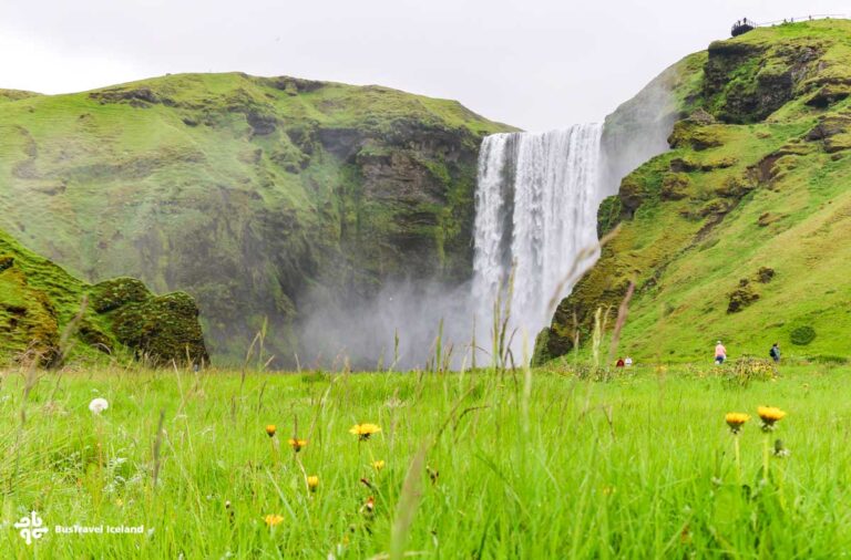
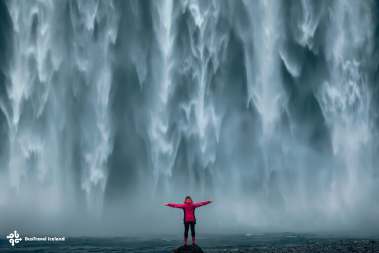
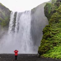
1 Skógafoss WaterfallSkógafoss Waterfall is a 60m high waterfall where the Skógá river terminates over what was once sea cliffs. The coastline has receded here leaving this stunning vertical waterfall behind. The intensity and power create a permanent mist or spray around the area which can often lead to rainbows around the falls on a sunny day.
Skógafoss is actually the last in a series of waterfalls working their way down from the highlands. If you take up the challenge and climb the steep staircase of 527 steps to the top viewing platform, you are not only rewarded with a bird´s eye view, but you can follow a trail up the mountain passing countless smaller falls along the way. This is actually the starting point of the Fimmvörðuháls trail, a 22km route to the highland area, Thorsmörk. From there many hikers continue on the Laugavegur trail all the way to Landmannalaugar. In a sense then, Skógafoss is the entrance to the highlands of Iceland.

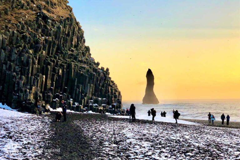
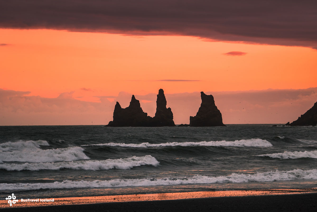
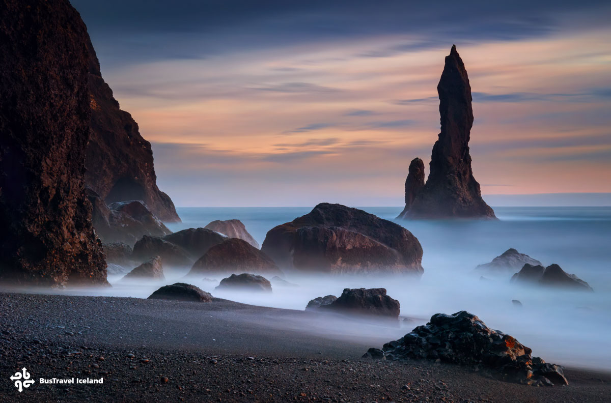
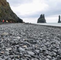
2 Reynisfjara BeachOne of the most visited and beloved of all Iceland attractions, there is an otherworldly, elemental quality to the landscape here. The competing forces of lava and the sea interacted here to create a cliff of basalt columns, a large domed cave, and of course the famous black sand itself. Steaming lava from an eruption at the nearby Katla volcano once entered the sea here and the power of the sea in turn eroded and broke down this lava into the black sand we see today.
The sea can be wild here so make sure to follow your guide´s instructions and avoid the speaker waves which can be extremely dangerous.
Named in National Geographic’s Top Ten list of the world’s most beautiful non-tropical beaches.

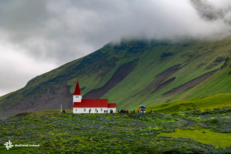
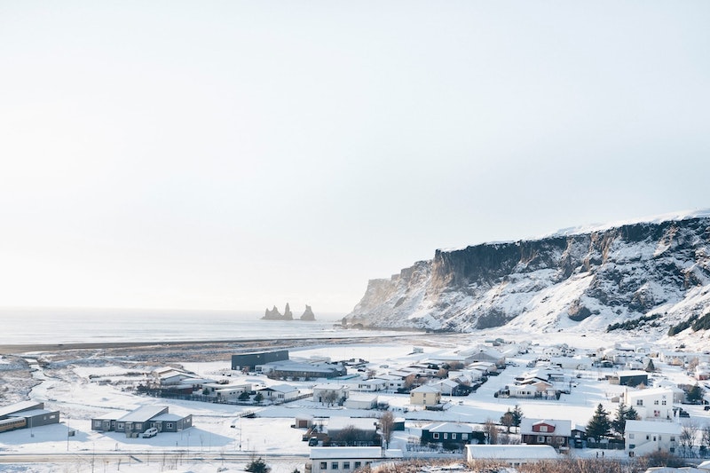
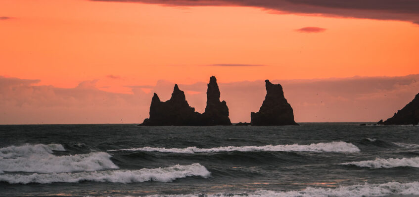
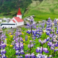
3 Vík VillageVík is a small village which is the southernmost on Iceland´s mainland. With views of Reynisdranger basalt columns to the south, a black beach, and a great panoramic view from the church on the hill, this is a charming little enclave.
Vík is directly south of Katla Volcano, a sleeping giant beneath Mýrdalsjökull glacier. An eruption here would most likely flood the town with glacier meltwater, a threat the town takes very seriously with frequent evacuation drills.
Here we will take our lunch stop.

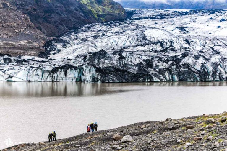
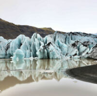
4 Sólheimajökull GlacierOur next stop is the Sólheimajökull Glacier. This is a so-called glacier tongue radiating from the larger Mýrdalsjökull. After taking the bumpy road we arrive at the parking lot. This parking lot was once situated alongside the glacier itself. The parking lot has not moved but the glacier itself has sadly much receded in past two decades, so much so that the walk to the ice from the parking lot now takes around 15 minutes.
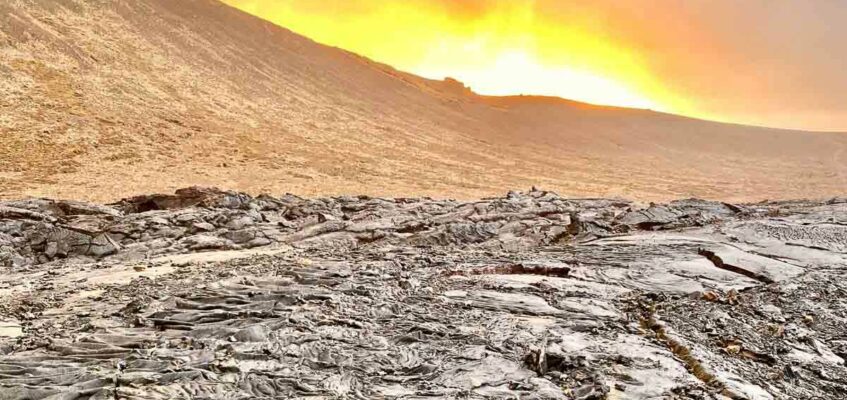
The trail to the edge of the glacier is over uneven terrain but it is not particularly hilly so is suitable for most everybody. We pass a large glacier lagoon which has formed from glacial meltwater. Large sections of the glacier have been known to break off into the lagoon, a process known as Glacier Calving. Your guide will discuss the science behind glaciers, their role in shaping the landscape and their future in the face of climate change. The glacier recedes more each year and the future is tragically most uncertain.

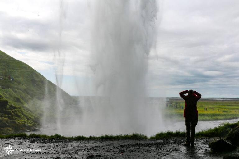
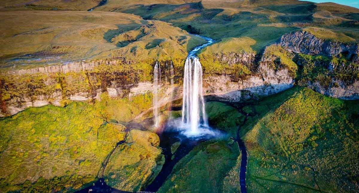
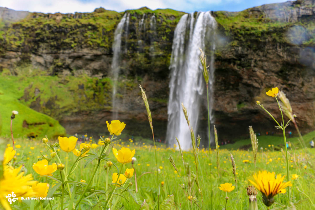
5 Seljalandsfoss WaterfallOur last stop of the day is to Seljalandsfoss waterfall, a highly memorable experience for all guests who join us on this tour. This elegant waterfall is 60m high, just like Skógafoss, but much less powerful. It is fed by the Seljalandsá river which originates beneath the Ejyafjallajökull glacier, another example of how different forces combine to form the landscape and features of the Icelandic countryside. Famously, there is a walking trail running behind the falls here, offering a unique, though wet perspective!
Seljalandsfoss also marks the entry to Thorsmörk nature reserve, located along a rocky road to the north of the waterfall. Close to Seljalandfoss, one can find Gljúfrabúi, a hidden waterfall and a favorite of photographers.
 Drop-offCentral Reykjavik
After Seljalandsfoss, we return west to the capital region. Our bus will drop you off to the same location from which you were picked earlier in the day.

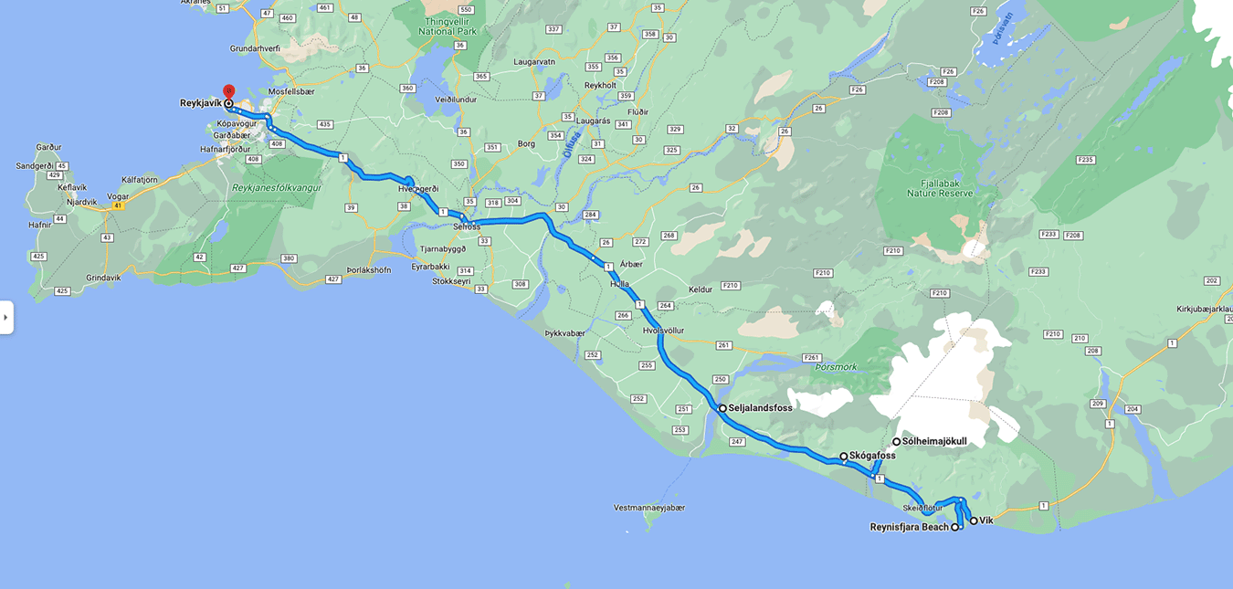


Your day begins with our fast and efficient pick up service which collects from various approved locations across the capital area. If in doubt, reach out to our customer service team who can advise you of the closest pickup location to your accommodation. Once everyone is onboard we set off eastwards before joining Route 1 highway, more commonly known as the Ring Road.
This route hugs the coastline for much of our day, which can often lead to windy conditions, with Reynisfjara especially a renowned wind-trap. Be prepared and dress accordingly. Depending on the conditions, the order in which we visit the stops can vary from day to day.
Be sure to look out for a view of the Westman Islands to the south and Hekla Volcano to the northeast.

Skógafoss Waterfall is a 60m high waterfall where the Skógá river terminates over what was once sea cliffs. The coastline has receded here leaving this stunning vertical waterfall behind. The intensity and power create a permanent mist or spray around the area which can often lead to rainbows around the falls on a sunny day.
Skógafoss is actually the last in a series of waterfalls working their way down from the highlands. If you take up the challenge and climb the steep staircase of 527 steps to the top viewing platform, you are not only rewarded with a bird´s eye view, but you can follow a trail up the mountain passing countless smaller falls along the way. This is actually the starting point of the Fimmvörðuháls trail, a 22km route to the highland area, Thorsmörk. From there many hikers continue on the Laugavegur trail all the way to Landmannalaugar. In a sense then, Skógafoss is the entrance to the highlands of Iceland.
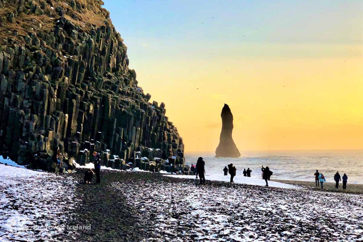
One of the most visited and beloved of all Iceland attractions, there is an otherworldly, elemental quality to the landscape here. The competing forces of lava and the sea interacted here to create a cliff of basalt columns, a large domed cave, and of course the famous black sand itself. Steaming lava from an eruption at the nearby Katla volcano once entered the sea here and the power of the sea in turn eroded and broke down this lava into the black sand we see today.
The sea can be wild here so make sure to follow your guide´s instructions and avoid the speaker waves which can be extremely dangerous.
Named in National Geographic’s Top Ten list of the world’s most beautiful non-tropical beaches.

Vík is a small village which is the southernmost on Iceland´s mainland. With views of Reynisdranger basalt columns to the south, a black beach, and a great panoramic view from the church on the hill, this is a charming little enclave.
Vík is directly south of Katla Volcano, a sleeping giant beneath Mýrdalsjökull glacier. An eruption here would most likely flood the town with glacier meltwater, a threat the town takes very seriously with frequent evacuation drills.
Here we will take our lunch stop.

Our next stop is the Sólheimajökull Glacier. This is a so-called glacier tongue radiating from the larger Mýrdalsjökull. After taking the bumpy road we arrive at the parking lot. This parking lot was once situated alongside the glacier itself. The parking lot has not moved but the glacier itself has sadly much receded in past two decades, so much so that the walk to the ice from the parking lot now takes around 15 minutes.
The trail to the edge of the glacier is over uneven terrain but it is not particularly hilly so is suitable for most everybody. We pass a large glacier lagoon which has formed from glacial meltwater. Large sections of the glacier have been known to break off into the lagoon, a process known as Glacier Calving. Your guide will discuss the science behind glaciers, their role in shaping the landscape and their future in the face of climate change. The glacier recedes more each year and the future is tragically most uncertain.
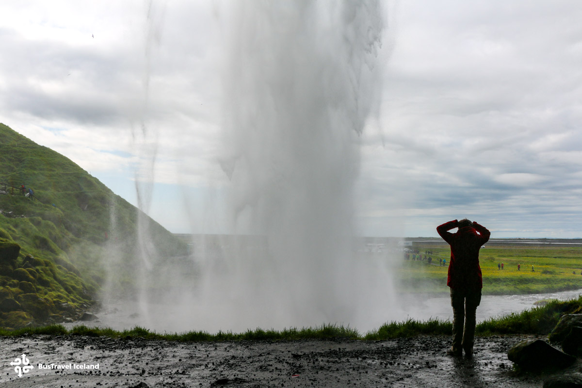
Our last stop of the day is to Seljalandsfoss waterfall, a highly memorable experience for all guests who join us on this tour. This elegant waterfall is 60m high, just like Skógafoss, but much less powerful. It is fed by the Seljalandsá river which originates beneath the Ejyafjallajökull glacier, another example of how different forces combine to form the landscape and features of the Icelandic countryside. Famously, there is a walking trail running behind the falls here, offering a unique, though wet perspective!
Seljalandsfoss also marks the entry to Thorsmörk nature reserve, located along a rocky road to the north of the waterfall. Close to Seljalandfoss, one can find Gljúfrabúi, a hidden waterfall and a favorite of photographers.

After Seljalandsfoss, we return west to the capital region. Our bus will drop you off to the same location from which you were picked earlier in the day.
