4-Day Laugavegur Trail Hiking & Camping Tour


The Laugavegur Trek is Iceland´s most famous hiking route and was rightly named one of the world´s top 20 hikes by National Geographic.
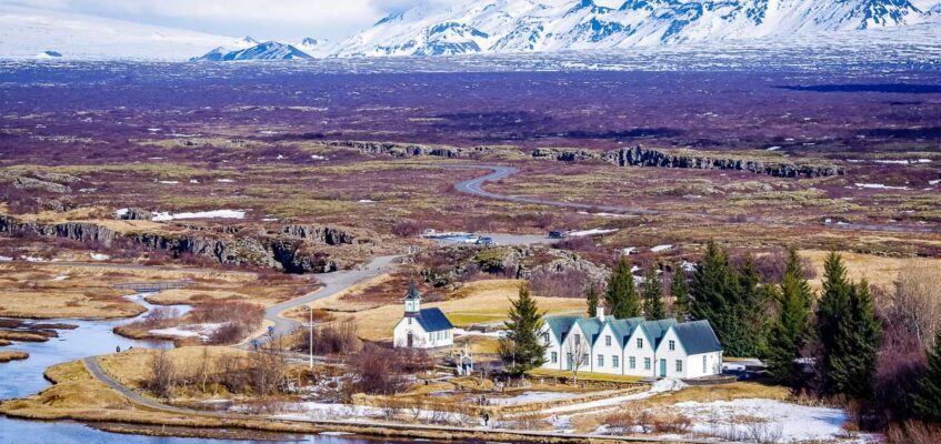
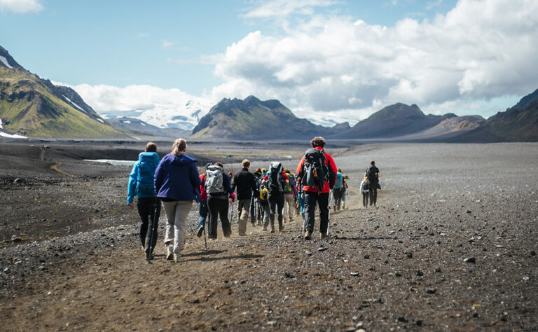
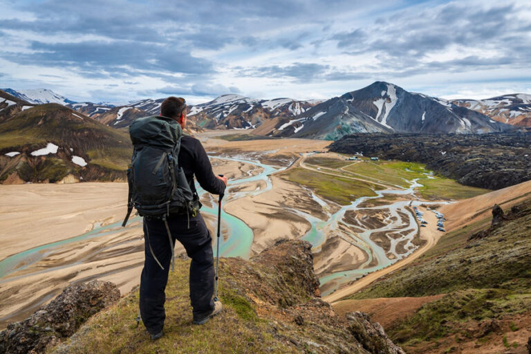
This highland route connects Landmannalaugar and Þórsmörk, with the landscape changing quite dramatically each day on the trail. The volcanic lava fields and hot-spring of Landmannalaugar give way to the desolute mountain top Hrafntinnusker. It changes once more as you approach the lush green pastures by Alftavatn lake. This is followed by a long section over the very flat black desert landscape as you make you way towards Emstrur. We finally descend into the birch woodlands of Thorsmork as our hike concludes. It really is remarkable the variety of landscapes you will encounter on the remarkable journey.
With our fully supported guided tour, we take care of all the practical concerns so that you can fully immerse yourself in nature as you tackle the ascents and descents of the hike. Your main gear bag will be shuttled for you from hut to hut, so you only need to carry the bare necessities.
You will stay at campgrounds where your tent will already pitched for you upon your arrival. Our staff will cook nutritious meals for you to keep you energy levels high, essential for any trek.
Hiking day-by-day
- Day 1 – 8 km (4.9 mi) Walking time: 4 hrs Ascent: 470 m (1540′)
- Day 2 – 24 km (14.9 mi) Walking time: 7 hrs Ascent: 900 m (2952′)
- Day 3 – 15 km (9.5 mi) Walking time: 6-7 hrs Descent: 40 m (130′)
- Day 4 – 15 km (9.5 mi) Walking time: 6-7 hrs Descent: 300 m (985′)

Tour highlights & itinerary
On this trek you will stay in tents at 3 different campgrounds; Landmannalaugar, Alftavatn, and Emstrur.
We provide the tents and thermal groundsheet. The base price includes a shared tent, but you can opt to pay the single-tent fee for more privacy.We also have a cooking and dining tent for meals and socialising. You have access to WC facilities on site.
Hot showers are available for a feee of ISK 500 for 5 minutes. These vouchers can be purchased from the warden on site.
There is no access to electricity on site, so best to bring a power bank to charge your devices.


- Professional hiking guide
- Transportation
- Luggage shuttle between campgrounds
- Camping fees, tent and insulation mattress
- All meals and snacks
- Hiking boots, poles, sleeping bag & waterproofs can be added for an additional fee
- Special dietary needs can be accommodated for an extra fee
- Hiking boots, thermal layers, rain gear
- Hat and gloves
- Sunglassses and sunscreen
- Sandals for river crossings
- Camera and refillable water bottle
- 25-40 L day back. Your larger bag will be shuttled from hut to hut for you
- USB power bank. No electricity in the mountain huts
- Difficulty Rating: Moderate. Estimated total elevation distance covered is 60km (37 miles) with elevation gain of around 1400m (4600ft) over 4 days
- Cancellation Policy: 50% cancellation fee if cancelled 2-14 days in advance of the tour. 100% charged if cancelled with less than 48 hours before start time.
Write a review
Share your experience with others.
Itinerary
Itinerary
 Reykjavik
We depart Reykjavík early in the morning, as we embark on the long drive to the highland region of Landmannalaugar. We leave the paved roads behind and take the bumpy gravel road to our campground for the first night.

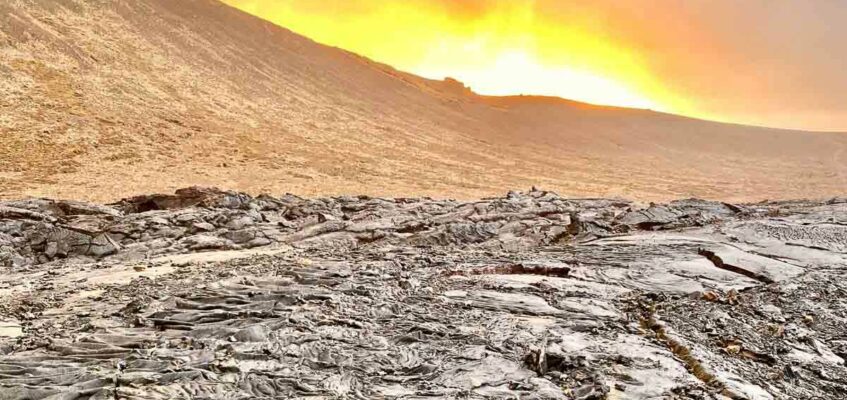
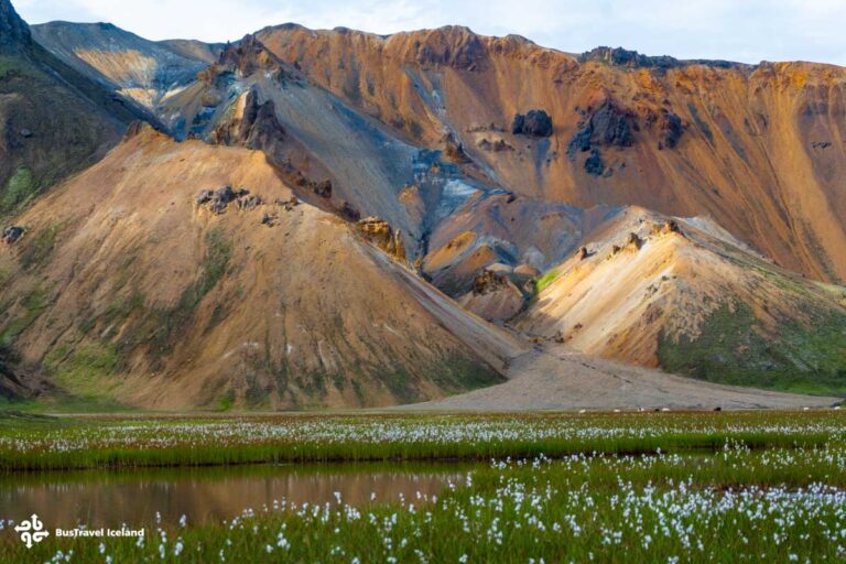
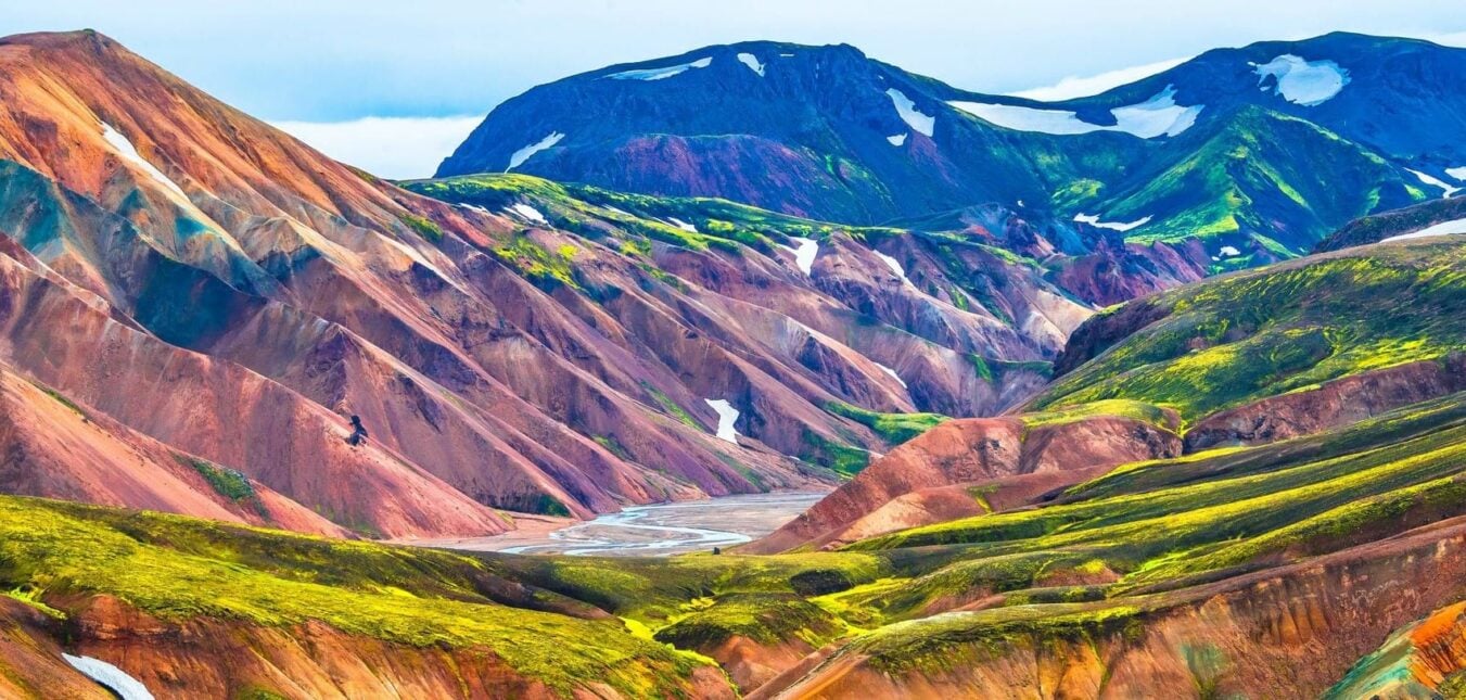
1 Day 1: LandmannalaugarAfter our long drive from the capital, we finally arrive to Landmannalaugar. This is the northern starting point for the Laugavegur trail, but we don´t start that trail until day 2. Instead we stretch our legs with a short day hike, good training for the more difficult days to come. We hike over the Laugahraun lava fields, and ascend Bláknúkur volcano. See the famed Grængil gorge. See the stunning colors of the famous ryholite hills.
On return to camp, we will enjoy the fabulous meal prepared by our staff and get to know each other a little better before our adventures to come. Bring you swimsuit along, and enjoy a dip in the soothing warm waters of the campgrounsd hot-springs.
Today´s hike: 8 km (4.9 mi) Walking time: 4 hrs Ascent: 470 m (1540′)

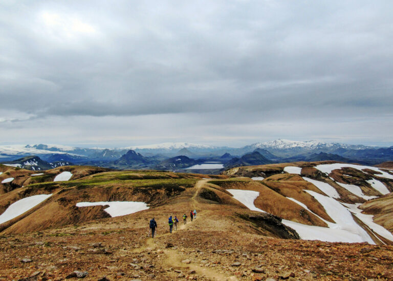
2 Day 2: Landmannalaugar to AlftavatnToday we finally take our first steps on the Laugavegur trail. Today is by far the longest distance covered as well as elevation gained on the trek, as we tackle snowfields and barren mountain trails to our destination for the night; Lake Alftavatn. After the challenging ascent to Hrafntinnusker, the trail evens out for a period before descending sharply towards the lake. From the crest of Jökultungur the whole landscape opens up, with astounding views all the way to Thorsmork and beyond revealing themselves. You can even see Mýrdalsjökull and Eyjafjallajökull glaciers to the far south.
The descent from here is somwhat techical and precarious, so we take it somewhat carefully. One at the bottom, we have a few small river crossings to negotiate before our arrival at the campgrounds. Our staff will have assembled the camp already, and dinner will ready for you soon after arrival. After 24km, the will be a most welcome respite!
Today’s Hike: 24 km (14.9 mi) Walking time: 7 hrs Ascent: 900 m (2952′)

3 Day 3: Alftavatn to EmstrurAfter a no doubt sound sleep, we tug on our backpacks for another day on the trail. After all the elevation gain yesterday, the flat desert plains today are a welcome relief. We cross a couple of more rivers, before reaching the vast, black sand landscape of Mælifellssandur. Pass by the ancient volcanoes Stórasúka and Hattafell as we make our way through this desert environment. We leave the black sand behind, as we crest some hills and steep sections, passing the impressive 200m deep Markarfljótsgljúfur canyon, carved by a glacial river.
The green hills at Emstrur are in sharp contrast to the monochrome black environment in which we have toiled for much of this day. We make camp and rest our weary bones.
Today´s Hike: 15 km (9.5 mi) Walking time: 6-7 hrs Descent: 40 m (130′)

4 Day 4: Emstrur to ThorsmorkToday, the last day of our trekking tour, we make one last push to the Thorsmork valley.
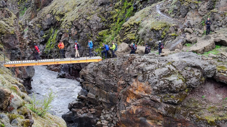
Soon after leaving Emstrur we cross over a footbridge over a looking river gorge. Not for the faint of heart! The landscape of the magnificient trail soon transforms once more to lush birch woodlands, as we approach the sheltered verdent valley on Thor.
Much of the day is spent negotiating Almmeningar which runs by the very distinctive Mt. Einhyrningur (Unicorn Mountain), with the few of the distant southern glaciers become very clearer.
Once the final river has been forded, we have short walk through the woods before arriving at Thorsmork. Congratuations, you have completed the Laugavegur Trail!
Today´s Hike: 15 km (9.5 mi) Walking time: 6-7 hrs Descent: 300 m (985′)
 Reykjavik
Having taken a short while to soak in the views of Thorsmork, we climb about our bus for the long haul back to Reykjavík. We ford some more rivers, before Seljalandsfoss waterfall marks our return to paved roads. After another 2 hours or so, you will be dropped off in Reykjavík.


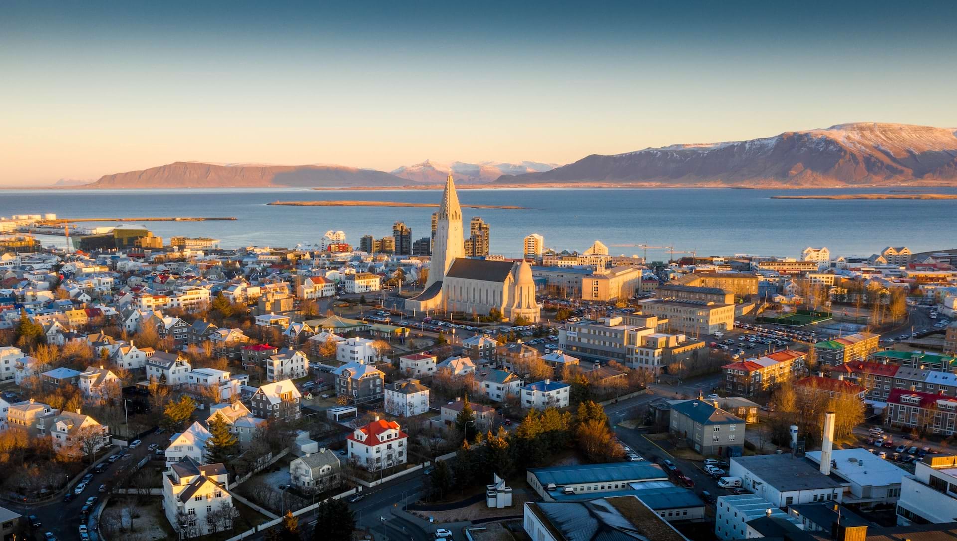
We depart Reykjavík early in the morning, as we embark on the long drive to the highland region of Landmannalaugar. We leave the paved roads behind and take the bumpy gravel road to our campground for the first night.

After our long drive from the capital, we finally arrive to Landmannalaugar. This is the northern starting point for the Laugavegur trail, but we don´t start that trail until day 2. Instead we stretch our legs with a short day hike, good training for the more difficult days to come. We hike over the Laugahraun lava fields, and ascend Bláknúkur volcano. See the famed Grængil gorge. See the stunning colors of the famous ryholite hills.
On return to camp, we will enjoy the fabulous meal prepared by our staff and get to know each other a little better before our adventures to come. Bring you swimsuit along, and enjoy a dip in the soothing warm waters of the campgrounsd hot-springs.
Today´s hike: 8 km (4.9 mi) Walking time: 4 hrs Ascent: 470 m (1540′)

Today we finally take our first steps on the Laugavegur trail. Today is by far the longest distance covered as well as elevation gained on the trek, as we tackle snowfields and barren mountain trails to our destination for the night; Lake Alftavatn. After the challenging ascent to Hrafntinnusker, the trail evens out for a period before descending sharply towards the lake. From the crest of Jökultungur the whole landscape opens up, with astounding views all the way to Thorsmork and beyond revealing themselves. You can even see Mýrdalsjökull and Eyjafjallajökull glaciers to the far south.
The descent from here is somwhat techical and precarious, so we take it somewhat carefully. One at the bottom, we have a few small river crossings to negotiate before our arrival at the campgrounds. Our staff will have assembled the camp already, and dinner will ready for you soon after arrival. After 24km, the will be a most welcome respite!
Today’s Hike: 24 km (14.9 mi) Walking time: 7 hrs Ascent: 900 m (2952′)

After a no doubt sound sleep, we tug on our backpacks for another day on the trail. After all the elevation gain yesterday, the flat desert plains today are a welcome relief. We cross a couple of more rivers, before reaching the vast, black sand landscape of Mælifellssandur. Pass by the ancient volcanoes Stórasúka and Hattafell as we make our way through this desert environment. We leave the black sand behind, as we crest some hills and steep sections, passing the impressive 200m deep Markarfljótsgljúfur canyon, carved by a glacial river.
The green hills at Emstrur are in sharp contrast to the monochrome black environment in which we have toiled for much of this day. We make camp and rest our weary bones.
Today´s Hike: 15 km (9.5 mi) Walking time: 6-7 hrs Descent: 40 m (130′)

Today, the last day of our trekking tour, we make one last push to the Thorsmork valley.
Soon after leaving Emstrur we cross over a footbridge over a looking river gorge. Not for the faint of heart! The landscape of the magnificient trail soon transforms once more to lush birch woodlands, as we approach the sheltered verdent valley on Thor.
Much of the day is spent negotiating Almmeningar which runs by the very distinctive Mt. Einhyrningur (Unicorn Mountain), with the few of the distant southern glaciers become very clearer.
Once the final river has been forded, we have short walk through the woods before arriving at Thorsmork. Congratuations, you have completed the Laugavegur Trail!
Today´s Hike: 15 km (9.5 mi) Walking time: 6-7 hrs Descent: 300 m (985′)

Having taken a short while to soak in the views of Thorsmork, we climb about our bus for the long haul back to Reykjavík. We ford some more rivers, before Seljalandsfoss waterfall marks our return to paved roads. After another 2 hours or so, you will be dropped off in Reykjavík.
